Date of survey: 03/12/2017
Volunteers: Jannike Allen, Judy Morrise
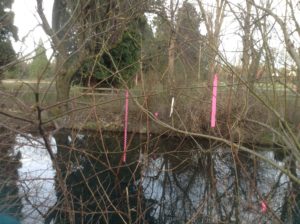
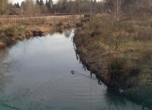
Instructions about the reach were a little confusing for the end part: it should be said that the trail in park is near Bybee Blvd. Also, at lat 45.464473, long -122.641574 there were a lot of pink tags that matched what would indicate redds, but they seemed to have different labels and nearby flags said wetland delineation. In the park by Bybee Blvd a beaver was seen swimming. The temperature testing was consistent (15 degrees C in 5 places: will email the lat/long for each), and it was important to have a long string to be able to reach down from bridges. At the most downstream bridge in Johnson Creek Park there is a water level board posted and it was at 0.9
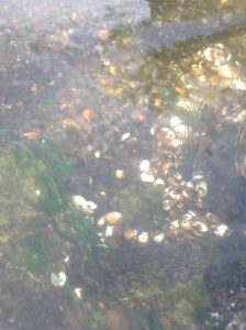
Through most of the creek the visibility was very clear (1), except at the park by Bybee, where it was a 3. At various points along the stream there were white shells with unknown origin.